
Stock Image
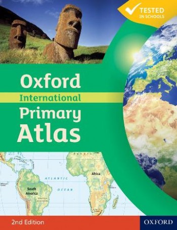
This new edition of the Oxford International Primary Atlas is clear, bright and informative. It includes up-to-date country data, easy-to-read colourful mapping, and worldwide topographic content, including areas such as Europe, Malta, Cyprus, Middle East, Malaysia and Hong Kong. It features key geographical themes such as landscapes, water, settlements, connections, and environments. Information is presented in an accessible format based on research into how young children use maps, and easy-to-use features include learning statements to summarize each theme, focus panels to prompt independent or group enquiry, innovative grid codes to help children find places listed in the index, many colourful photographs to aid children's understanding of map symbols, attractive artwork to provide a 'sense of place', and stimulating graphics to make large numbers easy to understand.The atlas includes:· Learning statements to introduce each geographical theme· Clear and colourful maps of the world and all the continents· Stunning aerial photographs and satellite images· Focus panels to prompt further enquiry and topic discussion· Child-friendly grid codes and index to support their use of the atlas. The Oxford International Primary Atlas is also accompanied by an Activity Book for independent work to develop map literacy skills. About the editor: Dr Patrick Wiegand taught in primary and secondary schools before being appointed to the School of Education at the University of Leeds where he trained teachers, taught on Masters' programmes and supervised PhD students. He became Head of Teacher Training at the University of Leeds and then Reader in Geography Education. He has researched children's thinking with maps and Geographic Information Systems (GIS) throughout his career and has published many books, chapters and research papers in this area including Learning and Teaching with Maps (Routledge, 2006). He was Chair of the Cartography and Children Commission of the International Cartographic Association, held a Leverhulme Research Fellowship in GIS in Education, and has served on the UK Committee for Cartography. He has always worked to improve the quality and usability of classroom teaching materials and has been Editorial Adviser for OUP atlases for 30 years.
More Description
This is a one stop primary atlas with excellent world topographic coverage targeted at the international schools market and English education worldwide.
Title: Oxford International Primary Atlas 2nd Revised Edition
Edition: Second Revised Edition
ISBN Number: 0198480229
ISBN-13: 9780198480228
Location Published: UK, Oxford University Press: 2011
Binding: Soft cover
Book Condition: New
Size: 29.2 x 22.6 x 0.7 cm
Kg: 0.35 Kg
Type: Book
Categories: SS Atlases, Atlases, CH Geography, Geography, SS Geography
Seller ID: 9780198480228
Keywords: 0198480229, 2e, 2nd revised edition, 9780198480228, edn, int, oxf, oxford international primary atlas, patrick wiegand, rev ed